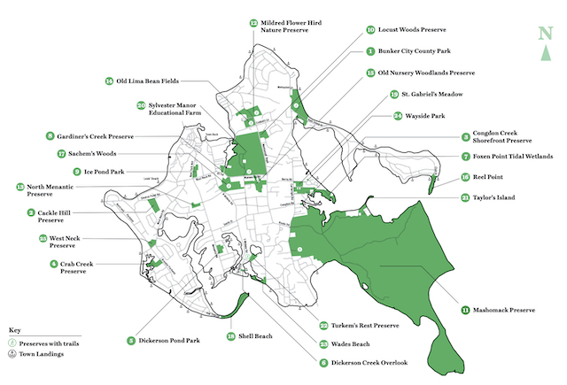
Shelter Island has a new open space map and copies are available at Town Hall. It updates an earlier map to include additional properties that have lately become accessible to the public.
The new trifold map, officially the “Town of Shelter Island Open Space & Preserved Lands Map”, was produced by the Town of Shelter Island Community Preservation Fund. Printing was supported by the Shelter Island Chamber of Commerce.
It features locations and descriptions of 25 areas open to the public on Shelter Island, from the smallest 0.75-acre Wayside Park on Burns Road to the largest 2,039-acre Mashomack Preserve.
“This map is provided by the Town of Shelter Island for the benefit of our community and visitors,” an introduction on the front page says. “It is the Town’s goal to protect the natural heritage of Shelter Island. The Town encourages the respectful public access to these treasured resources of woods, meadows, creeks, ponds, beaches and wildlife.”
Among the new locations included are the 6-acre North Menantic Preserve on the site of a undeveloped subdivision called Ned’s Lane, and the 7.7-acre West Neck Preserve at the corner of West Neck Road and Brander Parkway.
Credit is given to the many entities that contribute to the preservation of land here including: the Community Preservation Fund, the Town of Shelter Island, Suffolk County, New York State, The Nature Conservancy, Peconic Land Trust, and Sylvester Manor Educational Farm, as well as public and private contributions.
You can pick up a copy of the new map at Town Hall, or download it here.


